NTv2Poly - X 64-bit Download
Popular x64 Tags
- map x64 download
- city x64 download
- travel x64 download
- travel guides x64 download
- mapping x64 download
- city guides x64 download
- tk50 x64 download
NTv2Poly 7.00
Sponsored links:
license: Shareware ($185.00)
downloads: 36
size: 10.55 MB
updated: 2024-01-01
tags: inserting, insert, polygonal, validity, scope, scopes, NTv2, binary, file, outlines, outline, shape, shapefile, polygon, ntv2poly, killetsoft
Add to Basket
Killet GeoSoftware Ing.-GbR

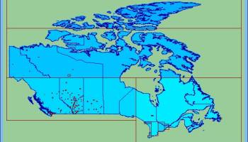
The spatial software NTv2Poly replaces the quadrangular activity scope contained in NTv2 files with a Polygonal Validity Scope, which is realized with an outline file in classic Shape Format. Invalid calculations outside the Polygonal Validity Scope thus can be excluded or acknowledged by a warning. Download the trial version from homepage Read the Worksheet at homepage Using NTv2 grid files it is possible to transform points from one coordinate reference system to another with very high accuracy. An NTv2 file contains one or more quadrangular coordinate grids which are defined in the NTv2 headers. Instead of a quadrangular area only an embedded polygonal area should and must be covered, for example, a state territory within the country borders. The program NTv2Poly realizes Polygonal Validity Scopes in NTv2 files. Using so prepared NTv2 files, coordinates outside the validity scope can be excluded from calculations or they can be acknowledged by a warning. This works with coordinate transformations using the geospatial software TRANSDATpro and GeoDLL by KilletSoft and with many GIS programs which support Polygonal Validity Scopes. The Polygonal Validity Scope is realized with a shape file, which contains the outlines of the scope as polygons. The file format Shape is developed by ESRI as a format for geographical objects. For example, in the shape file the border outlines of a country may be stored, which represent the polygonal scope for the NTv2 file used in that country. Using the program NTv2Poly the polygons of the shape file and the quadrangular surface of the NTv2 file are superimposed one on the other and processed in an ingenious manner. The program has a user-selectable multi language interface and comes with extensive online help. The program can be run on most common networks and it is possible to use Terminal Services on WINDOWS Servers.
OS: Win2000, Windows XP, Windows 7 x32, Windows 7 x64, Windows 8, Windows 10, WinServer, WinOther, Windows 2000, Windows 2003, Windows Server 2000, Windows Server 2003, Windows Server 2008, Windows Server 2008r2, Windows Server 2012, Windows Tablet PC Edition 2005, Windows Media Center Edition 2005, Windows Vista, Windows Vista x64
Requirements: Pentium, 30 MB HD
Add Your Review or 64-bit Compatibility Report
Top Geography 64-bit downloads

NTv2Tools 7.00
NTv2Tools - Tools for developing and processing binary and ASCII NT ...
Shareware | $185.00
tags: ntv2, file, analyzing, developing, processing, analysis, development, binary, ASCII, convert, converting, extract, ntv2tools, killetsoft

21st century worldwide growth of Forest 8.24
21st century worldwide growth of Forest - a natural development simulation
Freeware
tags: 21st century, worldwide, growth, Forest, Nature, Clouds, CO2, Climate, Sunshine, Weather, Greenland, Science, Simulation, System Dynamics, dynamicons, Dynamic Applications


Google Earth 7.3.6.9750
Fly anywhere on Earth to view satellite imagery, maps, terrain, 3D buildings etc
Freeware

Find Distance Between Multiple World Cities Software 7.0
Find the distance between one or more cities in the world.
Shareware | $19.99

UTM Coordinate Converter 2.0.4
An application that can convert between various Geographic Coordinate Systems
Freeware


Justmapzz 5.9.6
geo browser with multi-route calculation, tracks manager (import/export, convers
Shareware | $9.40
GeoTransformer 4.6.2.0
GeoTransformer focuses on making it easier for geocachers to process GPX filles
Freeware

GPS TrackMaker 13.9.596
Combine GPS data editor & real-time navigation with Google Maps and Google Earth
Freeware
Members area
Top 64-bit Downloads
-
Swordfish x64 5.2.1
x64 trialware download -
Swordfish 5.2.1
x64 trialware download -
Unipro UGENE 64-bit 50.0
x64 freeware download -
BOINC 64-bit 7.6.33
x64 open source download -
Alpus 11.2.44
x64 freeware download -
MusicReader 1.1.339.0
x64 trialware download -
Anki 23.10.1
x64 freeware download -
SingleCrystal 5.0.0
x64 demo download -
Global Mapper x64 25.1
x64 demo download -
Earth Alerts 2024.1.50
x64 freeware download
Top Downloads
-
Swordfish x64 5.2.1
trialware download -
wxMaxima for Windows 19.09.1
open source download -
Swordfish 5.2.1
trialware download -
PARI/GP 2.13.3
open source download -
Astro-Vision LifeSign
Mini 1.2.0.5
freeware download -
Test Constructor 4.0.0.26
shareware download -
Typing Tutor Hindi
Mangal Gail 1.0
demo download -
PlotDigitizer 2.1.1
shareware download -
FET 6.19.3
open source download -
Advanced Trigonometry
Calculator 2.1.4
freeware download -
MimioStudio 12.30
trialware download -
Brain Workshop 4.8.4
open source download -
VerbAce-Pro 2.5.3
trialware download -
PTC Mathcad Express 3.1
freeware download -
GeoGebra 6.0.836.0
open source download