GeoTools - X 64-bit Download
Popular x64 Tags
- vb net x64 download
- dotnet x64 download
- net x64 download
- dll x64 download
- asp control x64 download
- asp net x64 download
- control x64 download
- library x64 download
- delphi x64 download
- smtp x64 download
- windows x64 download
- component x64 download
- mime x64 download
- activex x64 download
- email x64 download
- sdk x64 download
- html x64 download
- visual basic x64 download
- postnet x64 download
- pdf417 x64 download
- codabar x64 download
- mail x64 download
- unlimited developer license x64 download
- static library x64 download
- barcode x64 download
- code 93 x64 download
- correction levels x64 download
- dinamic library x64 download
- pdf x64 download
- vb net' x64 download
GeoTools 32.0
Sponsored links:
license: Open Source
downloads: 403
size: 93.30 MB
updated: 2024-09-27
tags: GeoTools, download GeoTools, GeoTools free download, geospatial data library, GIS library, Java GIS toolkit, GIS, manipulation, geospatial data, manipulate
Add to Basket
GeoTools

GeoTools, developed by the innovative minds at GeoTools, is a robust and versatile open-source Java library designed to empower developers with the tools needed for geospatial data manipulation and analysis. This powerful software is a staple in the geospatial community, providing a comprehensive suite of features that cater to a wide range of applications, from simple mapping tasks to complex spatial data processing.
At its core, GeoTools excels in handling various geospatial data formats, including shapefiles, GeoJSON, KML, and more. This flexibility ensures seamless integration with existing datasets and workflows, making it an invaluable asset for developers working in diverse environments. The library's architecture is modular, allowing users to cherry-pick the components they need, thereby optimizing performance and resource utilization.
One of the standout features of GeoTools is its extensive support for Coordinate Reference Systems (CRS). The software includes a rich set of tools for transforming and projecting spatial data between different coordinate systems, ensuring that your data is always accurately represented. This capability is crucial for applications that require precise geolocation and mapping, such as environmental monitoring, urban planning, and navigation systems.
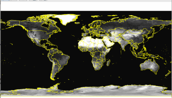
GeoTools also boasts a powerful rendering engine that can produce high-quality maps and visualizations. The rendering capabilities are highly customizable, enabling developers to create visually appealing and informative maps tailored to their specific needs. Whether you're building a web-based mapping application or a desktop GIS tool, GeoTools provides the rendering prowess needed to bring your spatial data to life.
In addition to its core functionalities, GeoTools is backed by a vibrant and active community. This community-driven approach ensures continuous improvement and innovation, with regular updates and a wealth of resources available for users. The extensive documentation, tutorials, and example projects make it easy for newcomers to get up to speed, while the active forums and mailing lists provide a platform for experienced users to share insights and collaborate.
GeoTools is also designed with interoperability in mind. It plays well with other geospatial libraries and tools, such as GDAL and JTS, allowing developers to leverage the strengths of multiple libraries within a single project. This interoperability extends to various programming languages through bindings and wrappers, making GeoTools a versatile choice for multi-language development environments.
Security and reliability are paramount in geospatial applications, and GeoTools does not disappoint. The software is rigorously tested and adheres to industry standards, ensuring that your applications are built on a solid foundation. The open-source nature of GeoTools also means that the code is transparent and subject to peer review, further enhancing its reliability and security.
In summary, GeoTools by GeoTools is a comprehensive and flexible geospatial Java library that stands out for its robust data handling, extensive CRS support, powerful rendering capabilities, and strong community backing. Whether you're a seasoned GIS professional or a developer new to the geospatial realm, GeoTools provides the tools and resources needed to build sophisticated and reliable geospatial applications.
At its core, GeoTools excels in handling various geospatial data formats, including shapefiles, GeoJSON, KML, and more. This flexibility ensures seamless integration with existing datasets and workflows, making it an invaluable asset for developers working in diverse environments. The library's architecture is modular, allowing users to cherry-pick the components they need, thereby optimizing performance and resource utilization.
One of the standout features of GeoTools is its extensive support for Coordinate Reference Systems (CRS). The software includes a rich set of tools for transforming and projecting spatial data between different coordinate systems, ensuring that your data is always accurately represented. This capability is crucial for applications that require precise geolocation and mapping, such as environmental monitoring, urban planning, and navigation systems.
GeoTools also boasts a powerful rendering engine that can produce high-quality maps and visualizations. The rendering capabilities are highly customizable, enabling developers to create visually appealing and informative maps tailored to their specific needs. Whether you're building a web-based mapping application or a desktop GIS tool, GeoTools provides the rendering prowess needed to bring your spatial data to life.
In addition to its core functionalities, GeoTools is backed by a vibrant and active community. This community-driven approach ensures continuous improvement and innovation, with regular updates and a wealth of resources available for users. The extensive documentation, tutorials, and example projects make it easy for newcomers to get up to speed, while the active forums and mailing lists provide a platform for experienced users to share insights and collaborate.
GeoTools is also designed with interoperability in mind. It plays well with other geospatial libraries and tools, such as GDAL and JTS, allowing developers to leverage the strengths of multiple libraries within a single project. This interoperability extends to various programming languages through bindings and wrappers, making GeoTools a versatile choice for multi-language development environments.
Security and reliability are paramount in geospatial applications, and GeoTools does not disappoint. The software is rigorously tested and adheres to industry standards, ensuring that your applications are built on a solid foundation. The open-source nature of GeoTools also means that the code is transparent and subject to peer review, further enhancing its reliability and security.
In summary, GeoTools by GeoTools is a comprehensive and flexible geospatial Java library that stands out for its robust data handling, extensive CRS support, powerful rendering capabilities, and strong community backing. Whether you're a seasoned GIS professional or a developer new to the geospatial realm, GeoTools provides the tools and resources needed to build sophisticated and reliable geospatial applications.
OS: Windows 11, Windows 10 32/64 bit, Windows 8 32/64 bit, Windows 7 32/64 bit
Add Your Review or 64-bit Compatibility Report
Top Components & Libraries 64-bit downloads


Document .Net 2026.3.5
Effortlessly convert and manipulate documents in various formats with ease.
Demo | $990.00


Devart ODAC 14.0.0
Delphi, C++Builder and Lazarus component library for direct access to Oracle
Shareware | $229.95
tags: delphi components, odac, delphi oracle, dac, vcl, lcl, net, delphi, rad studio, rad studio xe8, bds, core lab, data access components, bde, c++builder, turbo, c++, mac os x, android, linux, lazarus, freebsd, fpc, free pascal

Members area
Top 64-bit Downloads
-
dotNet Sniffer 64-bit
x64 2.0
x64 freeware download -
PDF Viewer SDK ActiveX
x64 8.5
x64 shareware download -
Software Ideas Modeler
Portable x64 14.55
x64 freeware download -
DotNetBrowser 3.5.0
x64 commercial download -
HPC Pack 2008 R2 SDK x64 3.3.3950 SP3
x64 freeware download -
Microsoft Speech SDK 11
x64 freeware download -
HDFView x64 3.3.2
x64 freeware download -
PyScripter x64 4.3.4
x64 open source download -
exe4j x64 9.0
x64 demo download -
Dart Editor 2.19.6
x64 open source download
Top Downloads
-
NASM 2.16.01
open source download -
WebData 10.2.4.0
shareware download -
Library .NET 19.8.8201
trialware download -
Delphi 12.0
shareware download -
PHP 8.5.4
open source download -
OpenWire 8.0.0.156
freeware download -
.NET Logging Library 2.20
shareware download -
jPDFImages 2021R1
demo download -
Document .Net 2026.3.5
demo download -
Swapy 0.5.4
open source download -
UtilsLib 7.2
demo download -
Python 3.14.3
open source download -
eWorld 0.9.3 Beta
freeware download -
.NET SFTP Library 6.13
shareware download -
Fiddler 5.0.20242.10753 Clas
trialware download