Garmin BaseCamp - X 64-bit Download
Popular x64 Tags
- freeware x64 download
- windows x64 download
- free x64 download
- web x64 download
- software x64 download
- folder x64 download
- utility x64 download
- monitor x64 download
- convert x64 download
- download x64 download
- tool x64 download
- video x64 download
- memory x64 download
- audio x64 download
- text x64 download
- password x64 download
- editor x64 download
- file x64 download
- security x64 download
- image x64 download
- database x64 download
- jpeg x64 download
- icon x64 download
- organizer x64 download
- viewer x64 download
- data x64 download
- print x64 download
- edit x64 download
- search x64 download
- pim x64 download
Garmin BaseCamp 4.7.5
Sponsored links:
Garmin Ltd.

The Garmin BaseCamp application was developed to be a powerful tool that provides an interface for viewing Garmin map products and managing geographic data.
Using the Map
The basic map contains major cities, roads, and highways. Other map products contain additional information, such as streets, addresses, points of interest, or topographical information. Map data only appears if a map product is installed, unlocked, and selected.
Working with BirdsEye Imagery and Garmin Custom Maps
You can download or import additional map information, called "overlays," which can be displayed on the map. You can save overlays on your computer or on a compatible Garmin device. You can work with overlays in the same manner as other data, including transferring overlays to and from compatible Garmin devices and organizing overlays using lists.
Working with Waypoints
A waypoint is a favorite location that you mark on the map. It can be an address, an existing map feature, a point of interest, or any other point on the map. You can use waypoints to mark places like your home, a camp site, or a favorite scenic point.
Working with Routes
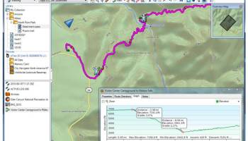
BaseCamp can calculate routes between two or more waypoints. BaseCamp shows routes as colored lines on the map. You can create routes in BaseCamp or transfer them from a Garmin GPS device.
Working with Filtered Routes
A filtered route follows a path that you draw on the map. When calculating a filtered route, BaseCamp automatically generates waypoints that are not saved in the Library and Devices area. You can use the route options to change the number of waypoints in a filtered route.
Working with Tracks
A track consists of a series of connected points that contain position and elevation information. You can transfer tracks created on your Garmin GPS device into BaseCamp. Tracks can be viewed on the map. You can also create and edit tracks on the map.
Managing Your Data
BaseCamp stores saved waypoints, routes, and tracks in the Library and Devices area. The Library and Devices area appears on the left side of the BaseCamp window. The Library and Devices area consists of two panes. The upper pane displays lists and connected devices. The lower pane displays the contents of the selected list or device.
FEATURES:
· Transfer data to and from your GPS device.
· Create, view, and edit waypoints, routes, and tracks.
· Organize saved waypoints, routes, tracks, and geocaches in the Library and Devices area.
· Find items, addresses, and Points of Interest (POIs) included in your detailed map data.
· View map data in 2D and 3D.
· View topographical information included in your detailed map data.
· Geotag photos with geographical location information.
· Print detailed topographical maps, Public Land Survey (PLS) quads, and multi-page poster maps.
· Download and view BirdsEye satellite imagery.
· Import and view Garmin Custom Maps.
Using the Map
The basic map contains major cities, roads, and highways. Other map products contain additional information, such as streets, addresses, points of interest, or topographical information. Map data only appears if a map product is installed, unlocked, and selected.
Working with BirdsEye Imagery and Garmin Custom Maps
You can download or import additional map information, called "overlays," which can be displayed on the map. You can save overlays on your computer or on a compatible Garmin device. You can work with overlays in the same manner as other data, including transferring overlays to and from compatible Garmin devices and organizing overlays using lists.
Working with Waypoints
A waypoint is a favorite location that you mark on the map. It can be an address, an existing map feature, a point of interest, or any other point on the map. You can use waypoints to mark places like your home, a camp site, or a favorite scenic point.
Working with Routes
BaseCamp can calculate routes between two or more waypoints. BaseCamp shows routes as colored lines on the map. You can create routes in BaseCamp or transfer them from a Garmin GPS device.
Working with Filtered Routes
A filtered route follows a path that you draw on the map. When calculating a filtered route, BaseCamp automatically generates waypoints that are not saved in the Library and Devices area. You can use the route options to change the number of waypoints in a filtered route.
Working with Tracks
A track consists of a series of connected points that contain position and elevation information. You can transfer tracks created on your Garmin GPS device into BaseCamp. Tracks can be viewed on the map. You can also create and edit tracks on the map.
Managing Your Data
BaseCamp stores saved waypoints, routes, and tracks in the Library and Devices area. The Library and Devices area appears on the left side of the BaseCamp window. The Library and Devices area consists of two panes. The upper pane displays lists and connected devices. The lower pane displays the contents of the selected list or device.
FEATURES:
· Transfer data to and from your GPS device.
· Create, view, and edit waypoints, routes, and tracks.
· Organize saved waypoints, routes, tracks, and geocaches in the Library and Devices area.
· Find items, addresses, and Points of Interest (POIs) included in your detailed map data.
· View map data in 2D and 3D.
· View topographical information included in your detailed map data.
· Geotag photos with geographical location information.
· Print detailed topographical maps, Public Land Survey (PLS) quads, and multi-page poster maps.
· Download and view BirdsEye satellite imagery.
· Import and view Garmin Custom Maps.
OS: Windows 7, Windows 7 x64, Windows 8, Windows 8 x64, Windows 10, Windows 10 x64, Windows 11
Add Your Review or 64-bit Compatibility Report
Top Other 64-bit downloads


iSunshare iBypass Genius 3.1.2.1
bypass icloud activation lock and turn off FMI without password
Shareware | $19.95

Caffeine 1.98
Keep your computer awake effortlessly with Caffeine, the ultimate productivity tool.
Freeware

Windows 7 x64
Windows 7 x64 is the next release of the Windows client operating system
Trialware | $199.99


Chopping List 1.0.5.1
Split the content of text files into multiple new files using a custom delimiter
Freeware


Windows 10 x64 22H2
Windows 10 x64 demonstrates new levels of flexibility, navigation & familiarity
Trialware
Members area
Top 64-bit Downloads
-
HWiNFO64 6.28 B4200
x64 freeware download -
Windows 7 x64
x64 trialware download -
GRBackPro Server Backup
x64 11.2.0
x64 shareware download -
Windows 10 x64 22H2
x64 trialware download -
XtraTools Professional
x64 26.3.1
x64 shareware download -
EasyTune6 B24.0119.1
x64 freeware download -
DAR 2.7.14
x64 open source download -
Processor X32 or X64 1.5
x64 freeware download -
O&O MediaRecovery
64-bit 14.0.17
x64 demo download -
BusDog x64 0.2
x64 freeware download
Top Downloads
-
FreeCommander XE
Portable 2026 Build 941
freeware download -
FURY CTRL 2.0.65.0
freeware download -
FMDiff 4.0.5
demo download -
Open Files from XLSX to
XLS 5.2
shareware download -
Vim 9.2.0265
open source download -
Shell Tools 2.0.1
freeware download -
HWiNFO64 6.28 B4200
freeware download -
EaseUS Key Finder 4.1.6 Build 20240910
demo download -
Pitara 5.0.9583.34420
open source download -
iSunshare iBypass Genius 3.1.2.1
shareware download -
AnyMP4 Data Recovery 1.5.12
shareware download -
PCtransfer 1.0.0.1033
freeware download -
Software to Data
Recovery 5.8.4.1
shareware download -
Music Collection 3.9.7.3
freeware download -
WinFindr 1.9
shareware download