Grass GIS - X 64-bit Download
Popular x64 Tags
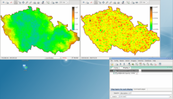
Grass GIS 8.2.0
Sponsored links:
license: Open Source
downloads: 64
size: 666.00 MB
updated: 2022-06-03
tags: geographical information, geographical system, resource analysis, geography, analysis, analyze
Add to Basket
GRASS Development Team

Commonly referred to as GRASS, this is a free Geographic Information System (GIS) used for geospatial data management and analysis, image processing, graphics/maps production, spatial modeling, and visualization. GRASS is currently used in academic and commercial settings around the world, as well as by many governmental agencies and environmental consulting companies. GRASS is an official project of the Open Source Geospatial Foundation.
Over the past decade Geographical Information Systems (GIS) have evolved from a highly specialized niche to a technology that affects nearly every aspect of our lives, from finding driving directions to managing natural disasters.
GRASS GIS is a general purpose raster/vector GIS combined with integrated image processing and data visualization subsystems. It includes a large number of modules for management, processing, analysis and visualization of georeferenced data.
Unlike most proprietary GIS, GRASS provides complete access to its internal structure and algorithms. Advanced users who want to write their own GIS modules may therefore learn from existing modules as well as by reading the ``GRASS Programmer's Manual''. The documented GRASS GIS libraries with the Application Programming Interface (API) make the new module development more efficient and allow to integrate new functionality into GRASS. Applications can be also written with shell scripts to automate the GIS workflow.
GRASS is currently used in academic and commercial settings around the world, as well as by many governmental agencies and environmental consulting companies.
OS: Windows 7, Windows 7 x64, Windows 8, Windows 8 x64, Windows 10, Windows 10 x64, Windows 11
Add Your Review or 64-bit Compatibility Report
Top Geography 64-bit downloads

NTv2Creator 6.14
Modeling of NTv2 files from Identical Points in two Reference Systems
Shareware | $535.00
tags: modelling, modeling, creation, create, generate, calculate, ntv2 file, ntv2, gsa, gsb, createing ntv2 file, modeling ntv2 file, geodetic, datum shift, datum, shift, ntv2creator, killetsoft

Google Earth 7.3.6.10155
Explore the world in stunning detail with interactive 3D maps and imagery.
Freeware

21st century worldwide growth of Forest 8.24
21st century worldwide growth of Forest - a natural development simulation
Freeware
tags: 21st century, worldwide, growth, Forest, Nature, Clouds, CO2, Climate, Sunshine, Weather, Greenland, Science, Simulation, System Dynamics, dynamicons, Dynamic Applications

GeoTransformer 4.6.2.0
GeoTransformer focuses on making it easier for geocachers to process GPX filles
Freeware

GPS TrackMaker 13.9.596
Combine GPS data editor & real-time navigation with Google Maps and Google Earth
Freeware
Find Distance Between Multiple World Cities Software 7.0
Find the distance between one or more cities in the world.
Shareware | $19.99

UTM Coordinate Converter 2.0.4
An application that can convert between various Geographic Coordinate Systems
Freeware


Justmapzz 5.9.6
geo browser with multi-route calculation, tracks manager (import/export, convers
Shareware | $9.40

Members area
Top 64-bit Downloads
-
Global Mapper x64 25.1
x64 demo download -
Zekr x64 1.1.0
x64 open source download -
MusicReader 1.1.339.0
x64 trialware download -
Chord Scale Generator
64-bit 1.3
x64 trialware download -
Language Reader 2.01
x64 freeware download -
Stellarium for Windows
(x64 bit) 24.2
x64 open source download -
GEDCOM Validator 64-bit 10.0.2.0
x64 freeware download -
Swordfish x64 5.4.0
x64 trialware download -
GAMA x64 1.6
x64 open source download -
Matrex x64 2.2
x64 open source download
Top Downloads
-
NTv2Creator 6.14
shareware download -
Quick Horse 20.1.13
trialware download -
BoneLab 2.3.27
demo download -
Octave 9.3.0
open source download -
subs2srs 29.3.0.0
open source download -
MartView 2.5.4
freeware download -
TR Assistant 2.03
demo download -
Quest 5.5 B5.5.5173.27952
freeware download -
Paralog 8.0.2
demo download -
STL Tracker 3.0.0.20
shareware download -
MecaNet 22.12.29
freeware download -
tapcode 0.1.1
open source download -
Aquile Reader 1.1.61.0
freeware download -
NTv2Tools 8.13
shareware download -
Epubor Ultimate 3.0.16 Build 583
demo download