3DField - X 64-bit Download
Popular x64 Tags
- photo editor x64 download
- software x64 download
- image editor x64 download
- image editing x64 download
- photos x64 download
- photoshop x64 download
- color x64 download
- design x64 download
- jpeg x64 download
- editor x64 download
- plugin x64 download
- image enhancement x64 download
- watermark x64 download
- exif x64 download
- rotate x64 download
- batch x64 download
- pictures x64 download
- graphics x64 download
- image x64 download
- digital camera x64 download
- photo x64 download
- graphic x64 download
- images x64 download
- resize x64 download
- paint x64 download
- camera x64 download
- digital x64 download
- digital imaging x64 download
- picture x64 download
- jpg x64 download
3DField 4.6.7.0
Sponsored links:
license: Demo
downloads: 454
size: 11.50 MB
updated: 2024-08-13
tags: surface, Vladimir Galouchko, map, data visualization, digitize image, download 3DField, terrain analysis, mapping software, 3DField free download, create contour map, 3DField, plotter, contour mapping, surface plot, mapper
Buy Now
Add to Basket
Vladimir Galouchko

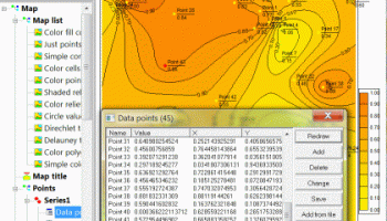
"3DField" by Vladimir Galouchko is a robust and versatile software designed for the creation of 3D surface maps and contour plots from your data sets. This powerful tool caters to a wide range of applications, from scientific research and engineering to environmental studies and geospatial analysis.
One of the standout features of 3DField is its user-friendly interface, which allows both novice and experienced users to navigate through its extensive functionalities with ease. The software supports a variety of data formats, making it highly adaptable to different data sources. Whether you're working with XYZ data, grid files, or even directly importing from Excel, 3DField ensures a seamless integration process.
The software excels in its rendering capabilities, producing high-quality 3D surface maps that are both visually appealing and highly informative. Users can customize their maps extensively, adjusting parameters such as color gradients, lighting, and perspective to highlight specific data trends and insights. The contour plotting feature is equally impressive, offering precise and detailed contour lines that can be fine-tuned to meet specific analytical needs.
3DField also includes advanced interpolation methods, allowing users to generate smooth and accurate surfaces from scattered data points. This is particularly useful for applications in geosciences, where data points may be irregularly spaced. The software's ability to handle large datasets efficiently ensures that even complex projects can be managed without performance issues.
Another notable feature is the software's export capabilities. 3DField allows users to export their maps and plots in various formats, including high-resolution images and 3D models, which can be easily shared or integrated into other software applications. This flexibility makes it an excellent tool for collaborative projects and presentations.
In terms of performance, 3DField is optimized to handle intensive computational tasks without compromising on speed or accuracy. The software's robust algorithms ensure that data processing is both quick and reliable, providing users with accurate results in a timely manner.
Vladimir Galouchko has also ensured that 3DField is continuously updated, incorporating user feedback and the latest technological advancements. This commitment to improvement keeps the software relevant and up-to-date with the evolving needs of its user base.
In summary, 3DField is a comprehensive and efficient tool for anyone needing to create detailed 3D surface maps and contour plots. Its combination of user-friendly design, advanced features, and high performance makes it a valuable asset for professionals across various fields. Whether you're a scientist, engineer, or geospatial analyst, 3DField offers the tools you need to visualize and interpret your data with precision and clarity.
Homepage: 3DField
OS: Windows 11, Windows 10 64 bit, Windows 8 64 bit, Windows 7 64 bit, Windows Vista, Windows XP 64 bit
Add Your Review or 64-bit Compatibility Report
Top Editors 64-bit downloads

CorelDRAW X5 2026 v27.0.0.121
Versatile graphic design suite for vector illustration and layout creation.
Trialware | $269.00


FreeFotoWorks 2026 26.1.4

Photo editing software for beginners and pro. All well-known photo effects.
Freeware


Photo Ninja 64-bit 1.4.0c
A professional-grade RAW converter that delivers exceptional detail
Trialware | $129.00

Members area
Top 64-bit Downloads
-
Fluid Mask for Mac 3.3.14
x64 trialware download -
ICO file format x64 2.1f1
x64 open source download -
Archicad 64bit 27 B3001
x64 demo download -
TopSpice 10.26a
x64 demo download -
Photo Ninja 64-bit 1.4.0c
x64 trialware download -
WellCAD x64 5.3 B625
x64 demo download -
Embird x64 2023 B10.86
x64 trialware download -
Portable MicroDicom x64 2024.2
x64 freeware download -
Adobe Photoshop Elements 2024.3
x64 trialware download -
Potrace for Windows (x64
bit) 1.16
x64 open source download
Top Downloads
-
CorelDRAW X5 2026 v27.0.0.121
trialware download -
Tracfoil 4.12.07
trialware download -
oCam 428.0
freeware download -
Gyazo 5.9.1
demo download -
MarvinSketch 23.16.0
freeware download -
Scanahand 8.0.0.320
demo download -
VueScan 9.8.53
demo download -
nanoCAD 5.1.2524.2017
freeware download -
MapInfo Professional 17.0.4
trialware download -
iWisdom 0.0.0+2107~ga0785ce1
open source download -
CodeLoader 4.19.0
freeware download -
SeiSee 2.22.6
freeware download -
XnConvert 1.106.0
shareware download -
GIMP 3.2.2
open source download -
Screenpresso 2.2.9
shareware download