Geographic Calculator - X 64-bit Download
Popular x64 Tags
- autocad x64 download
- solidworks x64 download
- intellicad x64 download
- dxf x64 download
- dwg x64 download
- architectural x64 download
- visualization x64 download
- cad x64 download
- home x64 download
- design x64 download
- hpgl x64 download
- progecad x64 download
- animation x64 download
- cam x64 download
- fence x64 download
- dwg to pdf x64 download
- architect x64 download
- vrml x64 download
- viz x64 download
- convert x64 download
- gear x64 download
- landscape x64 download
- strength check x64 download
- deck x64 download
- batch x64 download
- garden x64 download
- yard x64 download
- gardening x64 download
- landscaping x64 download
- backyard x64 download
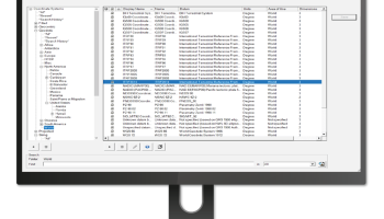
Geographic Calculator 2020 SP2
Sponsored links:
license: Trialware ($1499.00)
downloads: 581
size: 260.00 MB
updated: 2022-07-12
tags: geodetic data converter, convert geographic coordinate, map projection, Geography, geodetic, map
Add to Basket
Blue Marble Geographics

The Blue Marble Desktop is now the Geographic Calculator. The modules such as Geographic Transformer and Spatial Connect have been incorporated into Calculator and all functionality from them are available in the Calculator. There is also no more versioning for the Geographic Calculator, it will now be released annually with service packs between releases. If you have a Geographic Transformer license, you now will be able to access and use all functionality in the Calculator jobs and vice versa with a current license. Contact sales to upgrade and get more information.
Powerful geospatial data conversion and translation made easy! Believe it or not, it's true. For decades, Blue Marble has provided trusted software solutions that have simplified a not-so-simple part of GIS work, accurate data conversion. Ask around, our geodetic parameter data source is one of the most comprehensive and recognized in the GIS world. When your transformations have to be correct, consistent and certifiable, it has to be Blue Marble.
With this release the Geographic Calculator will be replacing the Blue Marble Desktop in name and functionality. All previous features available in the separate modules of the Blue Marble Desktop, (Geographic Calculator, Geographic Transformer and Spatial Connect) are now available with a license of Geographic Calculator 2013. Geographic Calculator 2013 also introduces a new streamlined license manager tool with automatic online licensing, the BMG Reprojector for the FME Workbench (additional license required), a new quick launch for Google Earth and support for the Finland Geiod FIN2000N00.
Features:
· Interactive conversion
· Point database conversion
· Seismic survey conversion
· Vector data conversion
· Raster format support
· Georeferencing - reference point selection
· Raster reprojection
OS: Windows 7, Windows 7 x64, Windows 8, Windows 8 x64, Windows 10, Windows 10 x64, Windows 11
Add Your Review or 64-bit Compatibility Report
Top CAD 64-bit downloads

Glise 1.7.1
A fast, clean, easy and extensible Catmull-Clark subdivision surfaces 3d modeler
Shareware | $119.00

DICOMscope 3.5.1
A free DICOM viewer which can display uncompressed, monochrome DICOM images
Freeware

ZWCAD 2020
ZWSOFT, an innovative supplier of CAD solutions to AEC and MCAD industries
Shareware | $799.00

GstarCAD 2021 Professional
Alternative CAD that is compatible, fast, lightweight and cost-effective
Shareware | $509.00


AutoFEM Analysis Lite 1.7
AutoFEM Analysis Lite provides the free finite element analysis for AutoCAD
Freeware
tags: autocad, finite element, analysis, stress, frequency, buckling, thermal, strength, force, temperature


Members area
Top 64-bit Downloads
-
cPicture (x64 bit) 4.1
x64 freeware download -
PhotoFiltre 11.6.1
x64 freeware download -
VanceAI 1.0.0.7
x64 shareware download -
Gimp for x64 Windows 2.10.38
x64 open source download -
Adobe Photoshop Elements 2024.3
x64 trialware download -
AcroPDF 6.2
x64 shareware download -
RIOT 2024.1.0
x64 freeware download -
Archicad 64bit 27 B3001
x64 demo download -
Rocket Propulsion
Analysis Lite x64 1.2.0
x64 freeware download -
Portable PhotoFiltre 11.6.1
x64 freeware download
Top Downloads
-
CorelDRAW X5 2025 26.2.0.29
trialware download -
Fotosizer 3.21.0.594
freeware download -
cPicture (x64 bit) 4.1
freeware download -
MSU Subtitle Remover
VirtualDub plugin 3.0beta2
freeware download -
PhotoFiltre 11.6.1
freeware download -
TinyPDF 3.00
freeware download -
Scripthea 3.0.0
open source download -
JPEG to PDF Converter 1.1
freeware download -
VanceAI 1.0.0.7
shareware download -
Pixlr 2.1.1
freeware download -
Zeus 1.5
freeware download -
Morpheus Photo Warper 3.17
shareware download -
Tourweaver Professional 7.98.181016
trialware download -
Free Catalog Maker 1.0
freeware download -
Flash Flip Book Planet
Theme 1.0
freeware download