MountainsMap Scanning Topography - X 64-bit Download
Popular x64 Tags
- autocad x64 download
- solidworks x64 download
- intellicad x64 download
- dxf x64 download
- dwg x64 download
- architectural x64 download
- visualization x64 download
- cad x64 download
- home x64 download
- design x64 download
- hpgl x64 download
- progecad x64 download
- animation x64 download
- fence x64 download
- cam x64 download
- dwg to pdf x64 download
- architect x64 download
- viz x64 download
- vrml x64 download
- convert x64 download
- gear x64 download
- landscape x64 download
- deck x64 download
- strength check x64 download
- batch x64 download
- garden x64 download
- yard x64 download
- gardening x64 download
- landscaping x64 download
- backyard x64 download
MountainsMap Scanning Topography 6.2.6266
Sponsored links:
Digital Surf

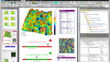
MountainsMap Scanning Topography is a professional application designed to perform surface analysis for 3D surface profilometers.
With MountainsMap Scanning Topography, users will be able to easily analyze measurements and metrology data. It features an extensive set of surface texture parameters.
FEATURES:
MountainsMap® Scanning Topography is the best in class surface analysis solution for profilometers
Entry level solution with a wide range of incremental optional modules for advanced applications.
Analyzes measurement data in accordance with the latest standards and methods.
Straightforward upgrade path to MountainsMap® Universal if you add a new type of instrument to your instrument park.
Real time high quality 3D imaging
View 3D surface topography in 24-bit colors, manipulate it in real time, apply different renderings and palettes, make movies of surface flyovers, etc.
Clean up measurement data using powerful filters to remove anomalies, correct scan lines, etc. and use morphological filtering or tip deconvolution to minimize stylus or spot shape impact.
Increase vertical range virtually
Increase vertical range by manually patching together overlapping measurements on the vertical axis.
The most popular 2D and 3D surface texture parameters
Calculate 3D height and bearing ratio parameters defined in the new ISO 25178 standard and EUR 15178 (Surfstand), ISO 4287 2D primary and roughness parameters, BSI, DIN, JIS, NF, UNE and UNI equivalents of ISO parameters, together with and ASME B46.1 3D parameters.
Basic analysis of surface texture and geometry
Calculation of distances, angles, areas, volumes and step heights.
3D surface roughness analysis based on ISO 16610 advanced filtering techniques.
Basic functional studies including bearing ratio curve, depth distribution histogram, surface subtraction and more.
Analyze sub-surfaces too
Use segmentation or thresholding to extract a sub-surface – for example a disk fixture ring, contact zone, MEMS layer or valley region - and analyze it independently, calculating parameters (e.g. flatness) for the sub-surface only.
Fast surface metrology report creation
The highly intuitive desktop publishing environment (in seven European languages, Japanese, Mandarin Chinese and Korean) includes a page viewer for fast navigation, an analysis workflow for full metrological traceability and pass/fail traffic lights.
Series of measurements can be analyzed automatically using templates and common sequences of analysis steps can be saved in a library for insertion in future reports.
Data export (Excel .csv, text, bitmap, PDF).
OS: Windows XP, Windows Vista, Windows Vista x64, Windows 7, Windows 7 x64
Add Your Review or 64-bit Compatibility Report
Top CAD 64-bit downloads

Tracfoil 4.12.07
Edit and print your ribs and airfoils templates from data
Trialware
tags: Cad, model, aircraft, plane, airfoil plotting, rib plotting, airfoil to DXF, airfoil, plot, rib

nanoCAD 5.1.2524.2017
nanoCAD - easy-to-use free CAD software delivering great user experience.
Freeware


MapInfo Professional 17.0.4
Location-based decisions: Explore, model and act with confidence
Trialware | $1 995.00
DICOMscope 3.5.1
A free DICOM viewer which can display uncompressed, monochrome DICOM images
Freeware

CrystalMaker 11.1.0
A full-featured scientific program, supporting the major database file formats
Demo | $499.00

Members area
Top 64-bit Downloads
-
Fluid Mask for Mac 3.3.14
x64 trialware download -
ICO file format x64 2.1f1
x64 open source download -
Archicad 64bit 27 B3001
x64 demo download -
TopSpice 10.26a
x64 demo download -
WellCAD x64 5.3 B625
x64 demo download -
Portable MicroDicom x64 2024.2
x64 freeware download -
Adobe Photoshop Elements 2024.3
x64 trialware download -
Potrace for Windows (x64
bit) 1.16
x64 open source download -
delaboratory x64 0.8
x64 open source download -
AcroPDF 6.2
x64 shareware download
Top Downloads
-
CorelDRAW X5 2026 v27.0.0.121
trialware download -
Tracfoil 4.12.07
trialware download -
oCam 428.0
freeware download -
Gyazo 5.9.1
demo download -
nanoCAD 5.1.2524.2017
freeware download -
MarvinSketch 23.16.0
freeware download -
MapInfo Professional 17.0.4
trialware download -
Scanahand 8.0.0.320
demo download -
iWisdom 0.0.0+2107~ga0785ce1
open source download -
CodeLoader 4.19.0
freeware download -
SeiSee 2.22.6
freeware download -
XnConvert 1.106.0
shareware download -
VueScan 9.8.53
demo download -
Topaz Simplify 4.1.1
trialware download -
World Tools 2.0.6
shareware download