JMARS for Windows - X 64-bit Download
Popular x64 Tags
- autocad x64 download
- solidworks x64 download
- intellicad x64 download
- dxf x64 download
- dwg x64 download
- architectural x64 download
- visualization x64 download
- cad x64 download
- home x64 download
- design x64 download
- hpgl x64 download
- progecad x64 download
- animation x64 download
- fence x64 download
- cam x64 download
- dwg to pdf x64 download
- architect x64 download
- vrml x64 download
- viz x64 download
- convert x64 download
- gear x64 download
- landscape x64 download
- deck x64 download
- strength check x64 download
- batch x64 download
- garden x64 download
- yard x64 download
- gardening x64 download
- landscaping x64 download
- backyard x64 download
JMARS for Windows 3.1.5
Sponsored links:
Arizona State University

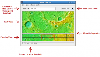
JMARS is an acronym that stands for Java Mission-planning and Analysis for Remote Sensing. It is a geospatial information system (GIS) developed by ASU's Mars Space Flight Facility to provide mission planning and data-analysis tools to NASA's orbiters, instrument team members, students of all ages, and the general public.
JMARS provides free and efficient access to more than a terabyte of NASA orbiter data, and has basic image and vector processing features to conveniently compare, plot, and blend data.
While JMARS began with a focus on Mars, it has branched out to work with data for Earth and the Moon, for which separate versions now exist. In all its variants, it's free to use and open-sourced, and is actively supported on Mac, Windows, Linux, and Solaris.
MARS can do a great many things; here are a few of them:
* Take multiple datasets (thermal inertia, mineral composition, digital elevations, etc.) and overlay them into a single, registered multilayer image.
* Make topographic profiles, extract surface temperatures (day or night), plot footprints and render remote sensing images from orbiters.
* Correlate mineral compositions with topographic data.
* Combine surface roughness data with thermal inertia data.
* Contour maps may be created.
* Groups of layers can be composed by transparency blending or building an HSV/RGB composite.
* Plots may be created by drawing multi-segment lines on the map, making it easy to sample elevation, thermal inertia, or other surface properties in an area of interest.
* Load and process raw numeric rasters, which may be stretched and colorized on the fly.
* Load and process vector data in several common formats.
* Edit vector data on the map or in a table.
* Use vector processing tools to calculate properties like line bearing or polygonal area.
* An SQL-like scripting language provides a powerful transformation and filtering feature.
And so on.
JMARS provides access to many Mars data products: image footprints and rasters from the THEMIS, MOC, CTX, HiRISE, CRISM, Viking Imaging System, HRSC, and OMEGA instruments; mosaics from THEMIS, Viking, and CTX; topography from MOLA; compositional maps from TES and GRS/HEND; albedo and thermal inertia from TES and Viking.
For the Moon, datasets include Clementine UV/VIS multispectral imaging, Lunar Orbiter imaging, Arecibo radar, and laser altimetry topography from Kaguya (Selene) and Lunar Reconnaissance Orbiter.
For Earth (in beta-development), datasets include topography and ASTER and MODIS multispectral imaging.
With all versions of JMARS (Earth, Moon, and Mars), new and improved datasets are being added continually, as quickly as instrument teams release them and the Planetary Data System makes them available.
Finally, if you are a science team member for Mars Odyssey, Mars Reconnaissance Orbiter, or Lunar Reconnaissance Orbiter, you can also use JMARS to plan observations, identify regions of interest, review previously acquired data, and examine datasets from past missions.
For more information, see the abstract from the JMARS presentation at the 2009 Fall Meeting of the American Geophysical Union.
The following provides links to some of the instruments and missions whose data is available through JMARS
OS: Windows Vista, Windows Vista x64, Windows 7, Windows 7 x64
Add Your Review or 64-bit Compatibility Report
Top CAD 64-bit downloads

Tracfoil 4.12.07
Edit and print your ribs and airfoils templates from data
Trialware
tags: Cad, model, aircraft, plane, airfoil plotting, rib plotting, airfoil to DXF, airfoil, plot, rib


MapInfo Professional 17.0.4
Location-based decisions: Explore, model and act with confidence
Trialware | $1 995.00

nanoCAD 5.1.2524.2017
nanoCAD - easy-to-use free CAD software delivering great user experience.
Freeware
Tabs for Publisher 8.50
Easily edit, read, and manage multiple files with tabbed browser in Publisher
Shareware | $19.00

Members area
Top 64-bit Downloads
-
ICO file format x64 2.1f1
x64 open source download -
Fluid Mask for Mac 3.3.14
x64 trialware download -
SimLab SKP Exporter for
SolidWorks x64 8.0
x64 trialware download -
Portable MicroDicom x64 2024.2
x64 freeware download -
CAD6 Industry 2022.1.8.16
x64 trialware download -
Archicad 64bit 27 B3001
x64 demo download -
Blue Cat's Protector x64 2.31
x64 demo download -
AstroTortilla x64 0.7.0.0
x64 open source download -
Potrace for Windows (x64
bit) 1.16
x64 open source download -
AcroPDF 6.2
x64 shareware download
Top Downloads
-
CorelDRAW X5 2026 v27.0.0.121
trialware download -
Tracfoil 4.12.07
trialware download -
MarvinSketch 23.16.0
freeware download -
Texmod 0.9b
freeware download -
CodeLoader 4.19.0
freeware download -
SeiSee 2.22.6
freeware download -
oCam 428.0
freeware download -
Gyazo 5.9.1
demo download -
iWisdom 0.0.0+2107~ga0785ce1
open source download -
MapInfo Professional 17.0.4
trialware download -
ImageConvertPro 2.01.07
shareware download -
ToandFromWebP 1.0.0.0
freeware download -
Anim8or 1.00
freeware download -
GIMP 3.0.8 Revision 2
open source download -
Scanahand 8.0.0.320
demo download