QGIS - X 64-bit Download
Popular x64 Tags
- autocad x64 download
- solidworks x64 download
- intellicad x64 download
- dxf x64 download
- dwg x64 download
- architectural x64 download
- visualization x64 download
- cad x64 download
- home x64 download
- design x64 download
- hpgl x64 download
- progecad x64 download
- animation x64 download
- fence x64 download
- cam x64 download
- dwg to pdf x64 download
- architect x64 download
- viz x64 download
- vrml x64 download
- convert x64 download
- gear x64 download
- landscape x64 download
- deck x64 download
- strength check x64 download
- batch x64 download
- garden x64 download
- yard x64 download
- gardening x64 download
- landscaping x64 download
- backyard x64 download
QGIS 3.36.1
Sponsored links:
license: Open Source
downloads: 357
size: 1000.00 MB
updated: 2024-03-26
tags: geographic information system, map creator, map viewer, GIS, geographic information, create, QGIS
Add to Basket
Gary Sherman

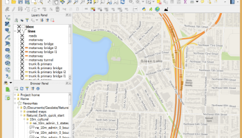
QGIS is a professional GIS application that is built on top of and proud to be itself Free and Open Source Software (FOSS).
QGIS supports vector, raster, and database formats and lets you browse and create map data on your computer.
QGIS supports many common spatial data formats (e.g. ESRI ShapeFile, geotiff). QGIS supports plugins to do things like display tracks from your GPS.
QGIS aims to be an easy to use GIS, providing common functions and features. The initial goal was to provide a GIS data viewer. QGIS has reached that point in its evolution and is being used by many for their daily GIS data viewing needs. QGIS supports a number of raster and vector data formats, with new support easily added using the plugin architecture.
Here are some key features of "QGIS":
· Support for spatially enabled PostgreSQL tables using PostGIS
· Support for ESRI shapefiles and other vector formats support by the OGR library
· MapInfo files
· GRASS integration, including view, edit, and analysis
· On the fly projection of vector layers
· Map composer
· Identify features
· Display attribute table
· Select features
· Label features
· Persistent selections
· Save and restore projects
· Support for raster formats supported by the GDAL library
· Change vector symbology (single, graduated, unique value, and continuous)
· SVG markers symbology (single, unique value, and graduated)
· Display raster data such as digital elevation models, aerial photography or landsat imagery
· Change raster symbology (grayscale, pseudocolor and multiband RGB)
· Export to Mapserver map file
· Digitizing support
· Map overview
· Plugins
· Improved vector and attribute editing
· Improved measure tools with area measuring
· Attribute searching
· New legend structure
· Refactoring of API to allow the use of QGIS libraries in mapping applications
· Improved MapServer export tool
· Vector layer transparency and antialiasing
· GRASS support in all platforms
· Enhanced GRASS support and toolbox commands
· Enhanced vector editing, including copy, cut, paste, snapping and vertex editing
· Shapefile/OGR layer editing
OS: Windows XP, Windows Vista, Windows Vista x64, Windows 7, Windows 7 x64, Windows 8, Windows 8 x64, Windows 10, Windows 10 x64, Windows 11
Add Your Review or 64-bit Compatibility Report
Top CAD 64-bit downloads

Tracfoil 4.12.07
Edit and print your ribs and airfoils templates from data
Trialware
tags: Cad, model, aircraft, plane, airfoil plotting, rib plotting, airfoil to DXF, airfoil, plot, rib


MapInfo Professional 17.0.4
Location-based decisions: Explore, model and act with confidence
Trialware | $1 995.00

nanoCAD 5.1.2524.2017
nanoCAD - easy-to-use free CAD software delivering great user experience.
Freeware
DICOMscope 3.5.1
A free DICOM viewer which can display uncompressed, monochrome DICOM images
Freeware

CrystalMaker 11.1.0
A full-featured scientific program, supporting the major database file formats
Demo | $499.00

Members area
Top 64-bit Downloads
-
Fluid Mask for Mac 3.3.14
x64 trialware download -
ICO file format x64 2.1f1
x64 open source download -
Archicad 64bit 27 B3001
x64 demo download -
WellCAD x64 5.3 B625
x64 demo download -
Portable MicroDicom x64 2024.2
x64 freeware download -
Adobe Photoshop Elements 2024.3
x64 trialware download -
TopSpice 10.26a
x64 demo download -
Potrace for Windows (x64
bit) 1.16
x64 open source download -
delaboratory x64 0.8
x64 open source download -
Photo Ninja 64-bit 1.4.0c
x64 trialware download
Top Downloads
-
CorelDRAW X5 2026 v27.0.0.121
trialware download -
Tracfoil 4.12.07
trialware download -
oCam 428.0
freeware download -
Gyazo 5.9.1
demo download -
MarvinSketch 23.16.0
freeware download -
MapInfo Professional 17.0.4
trialware download -
iWisdom 0.0.0+2107~ga0785ce1
open source download -
CodeLoader 4.19.0
freeware download -
nanoCAD 5.1.2524.2017
freeware download -
SeiSee 2.22.6
freeware download -
Scanahand 8.0.0.320
demo download -
VueScan 9.8.53
demo download -
Topaz Simplify 4.1.1
trialware download -
World Tools 2.0.6
shareware download -
Texmod 0.9b
freeware download